
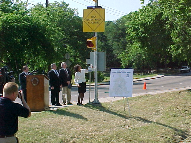
On April 25,
2000 the City of Dallas commissioned the Flooded Roadway Warning
System with a press conference hosted by councilperson
Southeast |
 From left to right: |
|
|
The Flooded Roadway Warning System is made up of three components:
The sensor monitors the elevation of a nearby stream and reports every twenty minutes to the central computer.
When the flood water reaches the edge of the roadway, a float switch tells the sensor to signal the sign to change to the warning text and turn on the flashing lights. The sign sends a message back to the sensor confirming that everything is working properly. The sensor radios all this information back to the central computer. Pages are sent to staff and messages are printed out at the appropriate Street Services district alerting them of the need to place barricades at this location as soon as possible.
The signs and sensors are battery powered and recharged with solar cells. All communication between the sensors and signs and sensors and the central computer are by radio.
The sensors normally controls the signs without intervention from the central computer. However, the central computer can issue commands to turn on the signs and lights.
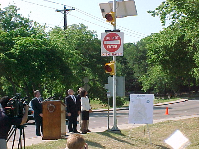
The signs include changeable text messages and red flashing lights. In the non-alarm state, the lights are off and the sign shows “High Water When Flashing”. In alarm state, the lights alternate flashing and the sign changes to “Do Not Enter High Water”. The signs and lights are equipped with sensors to detect the status.